In recent years, technological advancement in the construction sector has accelerated, with digital information increasingly reaching the construction site directly. As a result, the Virtual Geographic Information System (vGIS) has become an indispensable tool in construction.
vGIS in Construction
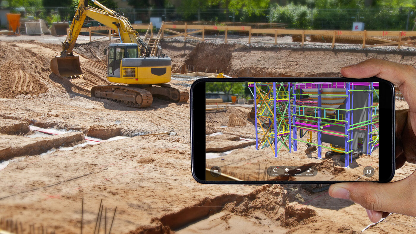
vGIS combines geographical precision, scanning capabilities, and augmented reality (AR) opportunities, offering revolutionary solutions from design to execution. In construction, vGIS is primarily used for scanning of construction sites, and visualization of construction projects.
Construction Site Scanning
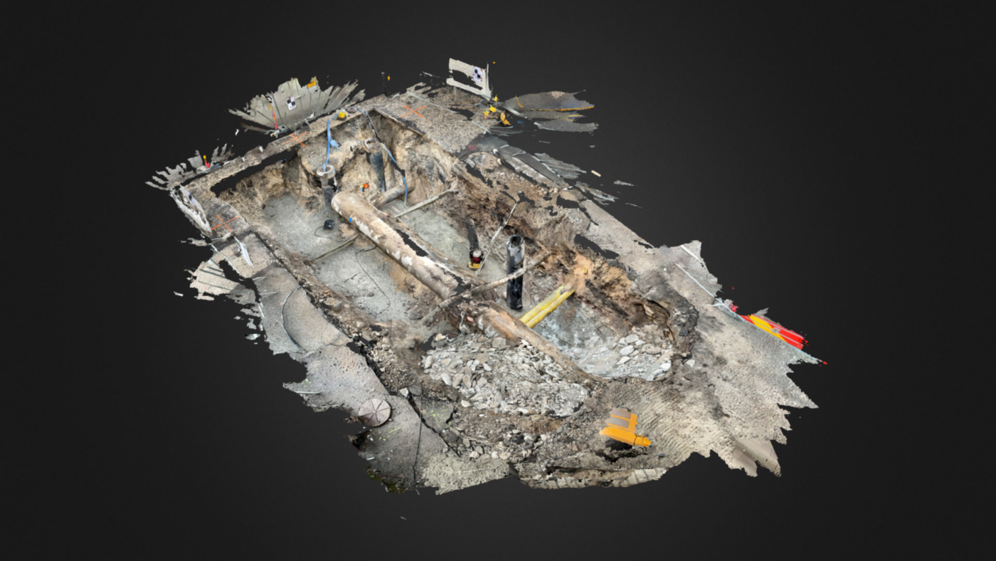
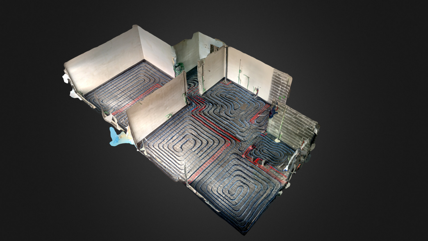
The use of vGIS technology on construction sites offers a significant advantage,allows for accurate 3D scanning directly with smartphones or tablets. This makes vGIS technology extremely accessible and user-friendly, as most people have access to such mobile devices. Users can quickly and precisely capture the current state of a construction site, and most importantly, easily, since no extensive prior knowledge is needed to use vGIS scanning. Accessories help ensure the precision of vGIS.
vGIS enables the integration of GNSS (Global Navigation Satellite System) devices, which offer centimeter-level accuracy in measurements. GNSS devices use satellite network signals to ensure the precision needed for construction.
Construction Site Supervision
Using scans made during the construction project, vGIS technology allows users to look back in time and display earlier phases of construction (see vGIS Inc. video), providing an opportunity to compare planned versus actual execution. Users can display a geometrically accurate model on the construction site using a smartphone/tablet, offering a visual and data-based supervision opportunity. In addition to monitoring, this also provides a good overview of the entire construction process and work efficiency.
It is important that the contractor consistently performs surveys on the construction site to verify each construction phase. In this case, a scan must be conducted at the end of each phase (see “vGIS Usage Requirements” chapter for more detailed usage requirements).
“Roll Back Time and Check Site Progress with vGIS” – vGIS Inc. Youtube.
Visualization of Construction Projects
vGIS allows for the visualization of construction projects even before the commencement of construction work. Thanks to AR technology, project stakeholders can participate in a virtual tour of the future building, which offers views of the building’s spatial distribution, design elements, and visual harmony. This enables a better understanding of the project’s scope and the identification of potential issues at an early stage, thereby helping to avoid corrective work in later phases of the project.
The model of the construction object is displayed directly on the smartphone screen using vGIS technology, which shows the object’s placement in the real world. By moving the camera, it is possible to explore the model from every angle, but it is also important to note that the model can be manually rotated.
To enhance visualization, it is possible to integrate VR glasses, which provide a better perception of reality for the observed object. By entering the virtual world, the user can imagine themselves, so to speak, in the future.
vGIS Usage Requirements
The vGIS platform is based on the Building Information Modeling (BIM) methodology. BIM is of critical importance throughout the construction project, ensuring an accurate model according to which the construction is executed. The construction can be based on various model design guidelines such as ÜBN, RKAS, Cobim, etc. However, it should be noted that the use of such guidelines is not mandatory. To ensure compliance with project requirements and success, it is necessary to base it on a geometrically accurate 3D model and/or a 2D base plan.
Usage Protocol
During construction, the contractor can perform scans of all building elements before they are covered or enclosed. The results of the scanning include:
– Pointcloud: In E57 or LAS format, which documents the physical status and dimensional indicators of the construction.
– Textured Mesh Model: Used to verify the correspondence between implementation models and actual construction work. The model must visually and dimensionally reflect the scanned area accurately.
Measurement Accuracy and Verification
The precision of measurements is within 1-3 cm for range and ±4 cm for positional accuracy.
When creating a BIM execution model, it is crucial to base it on data obtained from scans. The contractor must regularly verify that the execution model precisely matches the data collected in the scans. Any discrepancies or inconsistencies with reality found in the model are not acceptable and must be corrected.
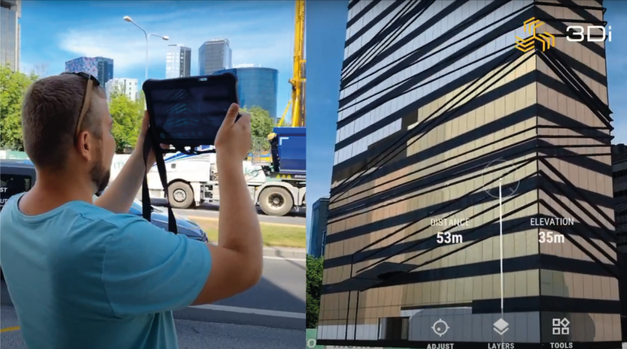
3Di video of vGIS usage in the marking of an utility network.
If you have any questions about the capabilities, implementation, or adoption of vGIS, please do not hesitate to contact us. Our team is ready to assist you comprehensively and ensure that vGIS helps you achieve your goals. Feel free to write to us!